

Bathymetry surveying
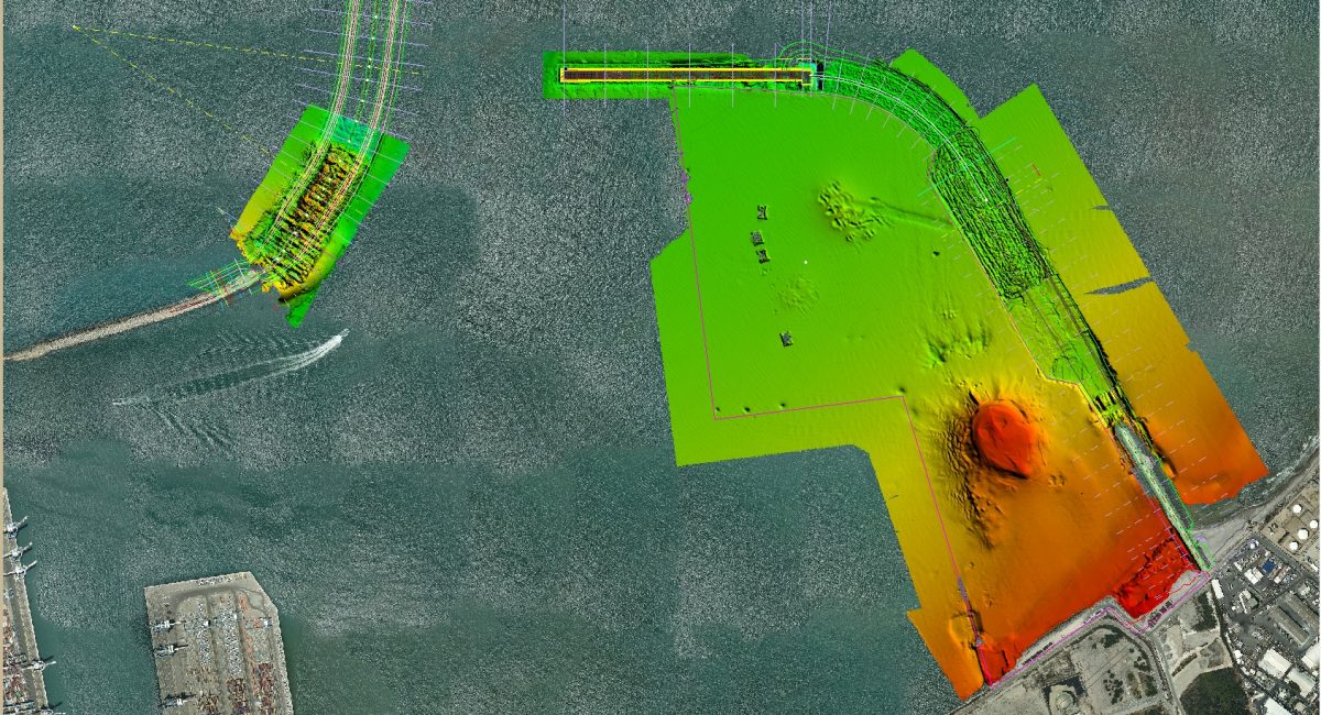
Modern seafloor mapping (Bathymetry) nowadays is achieved using the Multi-Beam Echosounder System (MBES). The MBES measures the seafloor in a swath like coverage, providing accurate high resolution measurement of the seafloor in a relatively short time.
MBES surveys are carried out all around the world for different purposes. Whether for worldwide ocean mapping, geological case studying or for marine construction purposes. MBES data not only provide depths, but also reflectance intensity, or “back-scatter” information which can shed some light on the type of sediment of the seafloor.
ADYR Construction utilizes the MBES mostly for underwater construction and dredging monitoring, and combines the data with above water drone photogrammetry to produce a full picture of the construction.
Drone surveying
During the past few years, drones are getting into almost every industry, the survey industry started to adopt drones in order ease topography survey and cover large areas rapidly while maintaining good accuracy.
Drone surveys utilizes the photogrammetry technology to produce highly accurate 3D topography in a very dense resolution and in significantly short time. When referencing the result to a few control points, measured with an accurate Total Station, a very dense high-quality 3D surface is produced in a relatively short amount of time.
ADYR employs certified drone operators (holding IAA certifications) and uses the most updated software(Pix4D) for processing the collected data to provide a full 3D topographic model.
Equipment
Boat: Fully equipped survey boat made by Stormer (Netherlands), model – Porter 68
Multibeam Sonar: Kongsberg 2040
Drone: DJI Phantom 4 RTK
Softwares: Kongsberg SIS, Caris, Qinsy, Qimera, Pix4D


